FREEHOLD, NJ – The Monmouth County Prosecutor’s office today released a map showing where the most incidents involving pedestrians and vehicles occurred.
The MCPO said the following in a statement:
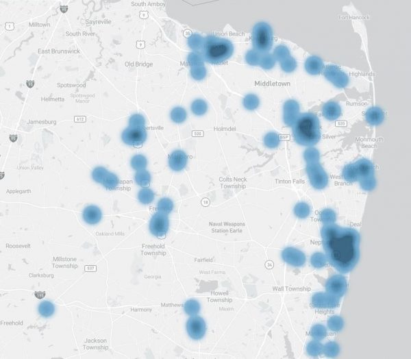
For the final day of #MCPOpedestriansafety Week, we’re going high-tech. The image shared here was created using a comprehensive database managed by the New Jersey DHTS to illustrate what areas of any jurisdiction statewide are marked by elevated rates of pedestrian injury. The darkened parts of the map represent more than 120 pedestrian strikes occurring across Monmouth County in 2019.
Some elements of the map you might expect – for example, municipalities with walkable downtown areas like Red Bank and Asbury Park tend to naturally have higher rates of such incidents. But some elements might come as a surprise – for example, the “hot spots” of incidents along Route 9 and in smaller Jersey Shore or Bayshore towns like Sea Bright and Keansburg.
We’d urge everyone to take a close look at this map and think about what areas you and your loved ones often drive through or walk in – keeping in mind to take a little extra care and maintain a little extra vigilance next time you’re in a hot spot! After all, 47 percent, nearly half, of the pedestrian strikes depicted here involved reported driver distraction.