The National Weather Service confirmed a minor Meteotsunami was created by Tuesday night’s passing thunderstorms.
At around 9pm, the NWS released a tsunami warning to residents along the Jersey Shore.
“Abnormal ocean water surges are expected along the oceanfront, inlets and back bays through the overnight hours,” the NWS said.
The NWS recorded the small tsunami on a buoy located off the coast of Point Pleasant and later off the coast of Atlantic City, prompting the warning.
There was no damage reported by the tsunami.
The alert…Get the hell off the beach…
Air pressure sensor and tidal gage readings in and near the
coastal waters indicate that a weather-generated tsunami has been
triggered by the line of thunderstorms as it moved over the ocean.

Impacts are expected along the oceanfront, inlets, and back bays
from Perth Amboy New Jersey to Fenwick Island Delaware.

Water level fluctuations of several inches to one foot above
normal astronomical tide in localized areas can be expected along
the oceanfront, inlets, and back bays for the next several hours
as a series of surges make their way to the coast.

The duration of this event is uncertain, though similar events
have lasted from several hours to one day. It is not recommended
to return to the water until at least Wednesday morning.

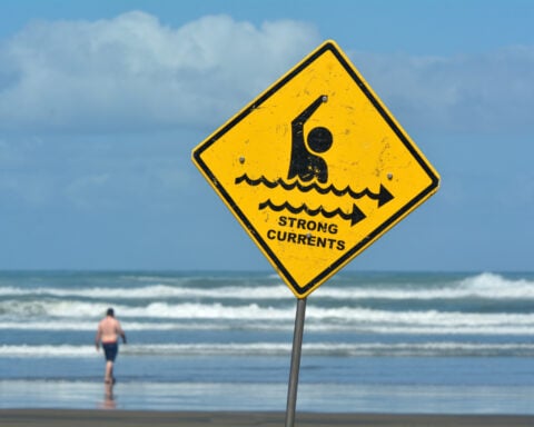
The strong currents associated with these surges could pose a
danger to those in or near the water.

Recommended actions are listed below...

Boat Owners...
 Prepare now for the following hazards...
  * Strong, unpredictable currents
  * Surging up to one foot above normal sea level

Swimmers...Surfers...and Boaters
 It is recommended you leave the beach now to avoid the following
 hazards...
  * Strong currents
  * Potentially dangerous surges of water.

This kind of tsunami is generated by abrupt changes of atmospheric
pressure in the causative storm system, which is a line of
thunderstorms that moved over the ocean in this case. The
combination of the air pressure effect on the ocean surface and
the speed at which the pressure disturbance travels can generate
tsunami like waves in certain situations. The National Tsunami
Warning Center is monitoring this event.
According to the National Weather Service…
Learn more about Meteotsunamis here.
On June 13, 2013, despite clear skies and calm weather, tsunami-like waves crashed upon the New Jersey and southern Massachusetts coasts. In Barnegat Inlet, New Jersey, three people were injured when a six-foot wave swept them off a jetty and into the water. The waves were captured by National Oceanic and Atmospheric Administration (NOAA) coastal water-level stations from Puerto Rico to New England as well as a Deep-Ocean Assessment and Reporting of Tsunamis (DART) buoy 150 miles offshore. Due to the wave’s coincidence with a severe weather pattern and the lack of a detected earthquake or landslide, scientists deemed the event a “meteotsunami.”
What is a Meteotsunami?
Meteotsunamis have the characteristics similar to earthquake-generated tsunamis, but are caused by air pressure disturbances often associated with fast moving weather systems, such as squall lines. These disturbances can generate waves in the ocean that travel at the same speed as the overhead weather system. Development of a meteotsunami depends on several factors such as the intensity, direction, and speed of the disturbance as it travels over a water body with a depth that enhances wave magnification.
Like an earthquake-generated tsunami, a meteotsunami affects the entire water column and can become dangerous when it hits shallow water, which causes it to slow down and increase in height and intensity. Even greater magnification can occur in semi-enclosed water bodies like harbors, inlets, and bays.
Most meteotsunamis are too small to notice, but large meteotsunamis can have devastating coastal impacts (although not to the extreme of the 2004 Indian Ocean and 2011 Japan tsunamis). Damaging waves, flooding, and strong currents can last from several hours to a day and can cause significant damage, injuries, and deaths.
A meteotsunami should not be confused with storm surge associated with tropical storms and other large coastal storms. Storm surge is a wind-driven effect that occurs when strong winds push water onshore, causing water levels to steadily rise over the course of several hours. Recent research has shown that meteotsunamis are more common than previously thought and suggests that some past events may have been mistaken for other types of coastal floods, such as storm surges or seiches, which also tend to be wind-driven.
Where Do Meteotsunamis Happen?
Meteotsunamis are regional in nature. In the United States, conditions for destructive meteotsunamis are most favorable along the East Coast, Gulf of Mexico, and in the Great Lakes, where they may pose a greater threat than earthquake-generated tsunamis. In addition to the 2013 event, notable U.S. meteotsunamis include:
May 27, 2012—Lake Erie: A seven-foot wave hit the shoreline near Cleveland, Ohio, sweeping beach-goers off of their feet and swamping boats in harbors.
October 28, 2008—Boothbay Harbor, Maine: A series of waves up to 12 feet high emptied and flooded the harbor at least three times over 15 minutes, damaging boats and shoreline infrastructure.
July 3, 1992—Daytona Beach, Florida: A 10-foot wave crashed onto shore shortly before midnight, injuring 75 people, damaging 100 vehicles, and causing property damage. If the wave had hit hours later, during July 4th festivities, the effects could have been much worse.
June 26, 1954—Lake Michigan: A 10-foot wave struck the shoreline near Chicago, Illinois, sweeping several people off piers. Seven lives were lost.
Certain parts of the world, such as areas in the Adriatic Sea, Mediterranean Sea, and a few of Japan’s gulfs and bays, are prone to meteotsunamis due to a combination of variables such as geography, weather patterns, and bathymetry (size, shape, and depth of the waterbody). The strongest meteotsunami on record struck Vela Luka, Croatia, in June 1978. The event featured 19.5-foot wave heights, lasted several hours, and caused significant damage to the port and boats. Since then, a number of other meteotsunamis with waves exceeding six feet have been observed along the Croatian coast. Ciutadella Harbor (Menorca, Spain) has also experienced significant events. Meteotsunamis in 1984 and 2006 each caused tens of millions of dollars in damage to the harbor and boats.
What Is Being Done to Forecast Meteotsunamis?
Despite the risk they pose and their worldwide occurrence, forecasting meteotsunamis remains a challenge. However, with recent increases in research as well as improved observational networks and forecast models, a reliable forecast and warning system for the United States is within reach.
The United States is still in the early stages of developing a meteotsunami forecast and warning system. Led by NOAA, these efforts include developing a process that outlines when, where, and how meteotsunami warnings should be issued based on high resolution air pressure measurements combined with meteotsunami forecast models.
The National Tsunami Hazard Mitigation Program (NTHMP) recognizes the risk that meteotsunamis pose and supports NOAA’s efforts to develop a meteotsunami forecast and warning system. In the meantime, the public should heed warnings issued by local National Weather Service Weather Forecast Offices, which can identify a potential coastal threat based on weather conditions. The NTHMP also encourages program partners to raise public awareness about meteotsunamis.