
Hurricane Lee is shifting its course to the north as it was downgraded again, this time to a category three hurricane. While the downgrade is good news, the bad news is, Lee is now heading in a more northerly direction.
Previously, Lee appeared to be headed straight for the Carolinas, but new models show that it could start heading toward the Mid-Atlantic.
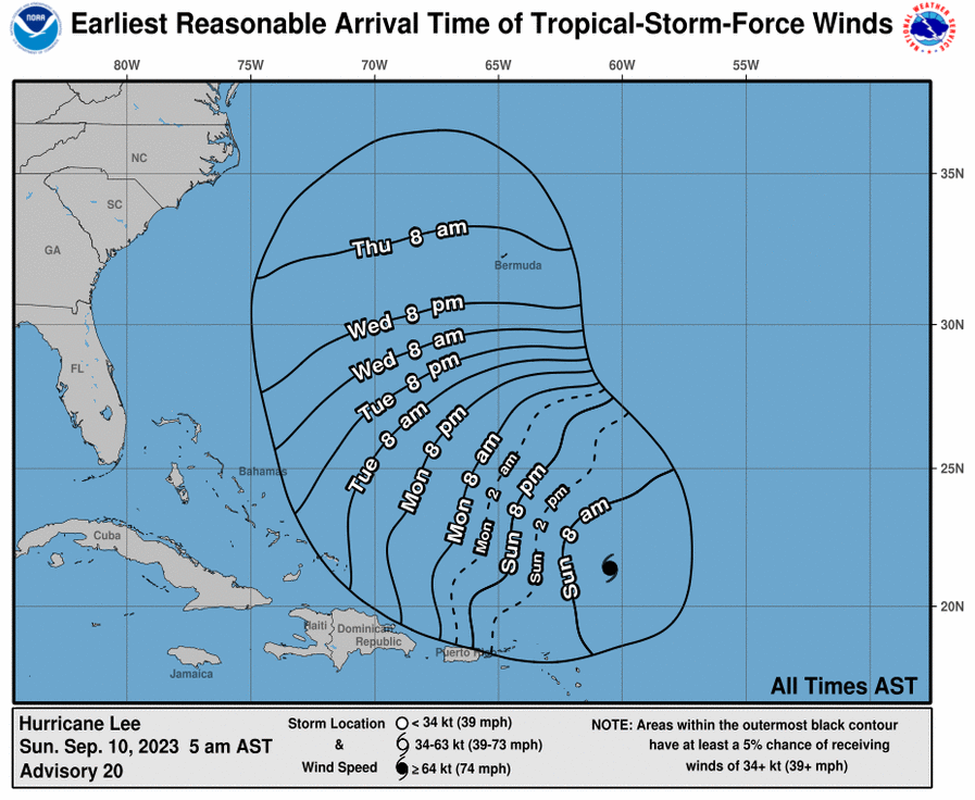
By Thursday morning, Lee is expected to be off the coast of North Carolina’s Outerbanks, and if it continues heading north, it could severely impact, at least, beaches and erosion at the Jersey Shore. At worst, a direct landfall.
But it’s too early to tell what the storm will do at this point. Residents along the entire East Coast should begin preparing for Lee’s arrival, whether it’s passing by offshore, or a direct hit.
Lee is expected to pickup steam again over the Atlantic Ocean, but weather conditions on the mainland could affect its course and possibly blow the storm out to see.
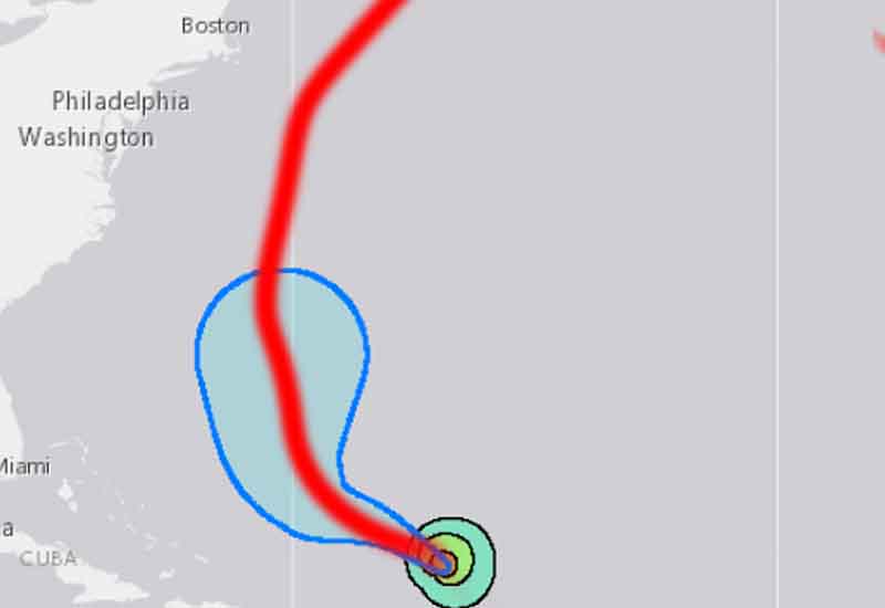
It’s too early to tell, but most models right now have the storm passing hundreds off miles off the coast. While that is good news for many, it could wreak havoc on already eroded beaches along the Jersey Shore and cause some coastal flooding with tropical storm level winds and rain as it heads into the North Atlantic.