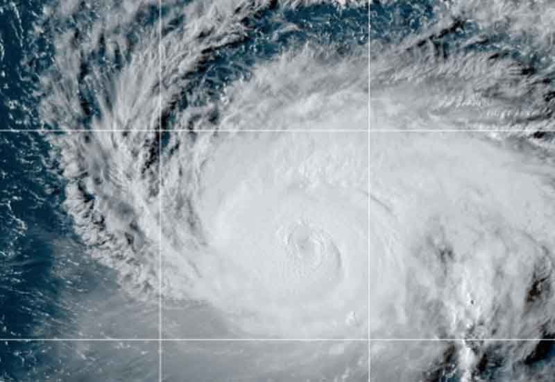
MOUNT HOLLY, NJ – Hurricane Lee continues to stay one step ahead of weather forecasters and the National Weather Service’s National Hurricane Center. While the storm is expected to continue northwest across the Atlantic, some models tonight are showing a possible East Coast landfall.
Current models show Lee hugging the coast from Cape Hatteras to Cape Cod, before heading northwest over Eastern Canada, but several models show possible landfall in the Long Island, Connecticut and Cape Cod area.
While averting a direct hit on Puerto Rico and the Virgin Islands, Category 3 Hurricane Lee still looms as a surf risk for the U.S. East Coast.
According to the National Hurricane Center, the storm, with winds reaching nearly 120 mph, is already a source of perilous rip currents across multiple regions. Affected areas span from the Lesser Antilles to Bermuda, including Puerto Rico, the British and Virgin Islands, Hispaniola, the Turks and Caicos Islands, and the Bahamas.
Initial signs of hazardous surf have emerged on the southeast coastline of the U.S. and are forecast to intensify and expand northward in coming days.
Though the storm is projected to pass to the west of Bermuda later this week, the extent and timing of possible wind, rain, and high surf impacts are not yet determined. No official coastal warnings or watches have been issued concerning Hurricane Lee at this time.
– As it veers north of the Leeward Islands, the Virgin Islands, and Puerto Rico, Hurricane Lee is regaining strength and posing an increasing surf threat across the Western Atlantic.
Recent data from an Air Force Reserve Hurricane Hunter aircraft reveals that Lee’s maximum sustained winds have risen to approximately 120 mph. Classified as a Category 3 on the Saffir-Simpson Hurricane Wind Scale, further intensification is anticipated in the next 24 to 48 hours, albeit with some possible fluctuations.
Currently moving west-northwest at around 8 mph, Lee is forecasted to maintain this general direction but at a slower pace in the coming days.
Though no coastal warnings or watches are currently in place, the potential for hazardous beach conditions is rising and is expected to spread through the Western Atlantic during the week.
The storm had briefly attained Category 5 status due to above-average water temperatures before being downgraded. Its renewed strengthening carries the risks associated with a Category 3 hurricane, including severe structural damage and prolonged utility outages.
The potential damage from a Category 3 storm includes destruction of robust structures, toppling of trees, and prolonged outages of vital utilities.
