
SEASIDE HEIGHTS, NJ – Hurricane Lee’s impact along the Mid-Atlantic seaboard will begin being felt as early as Tuesday according to the National Weather Service and the National Hurricane Center. Lee, still packing winds over 100 miles per hour is expected to pass by the region on Thursday into Friday.
Forecasters are still predicting Lee will pass by the coast a few hundred miles out to sea and could bring rains and tropical storm level winds, but a direct hit in the New Jersey tri-state area is not being completely ruled out at this time as the path of the storm is hard to predict with preciseness.
Most models show the storm staying out at sea, but the Jersey shoreline could be impacted with rough surf, high tides, and heavy waves that could further erode the state’s already eroded beach systems.
As if midnight, Hurricane Lee is tracking through the western Atlantic with maximum sustained winds of 115 mph, posing threats of hazardous surf and rip currents at beaches across the region.
The hurricane was located at 23.9°N 64.8°W, moving west-northwest at 7 mph, according to the latest advisory at 11:00 PM AST on Monday.
The minimum central pressure was recorded at 948 mb. Tropical storm force winds extend 150 nautical miles northwest and southeast, 160 nautical miles northeast, and 120 nautical miles southwest of the center of the storm.
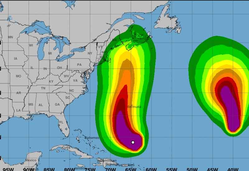
Sea conditions are also being heavily impacted, with waves reaching 12 feet or higher within 360 nautical miles of the northeast quadrant and 345 nautical miles of the northwest quadrant of the hurricane. Surrounding areas are experiencing winds ranging from 20 to 33 knots and sea heights between 12 to 23 feet.
The 24-hour forecast predicts that the hurricane will be near 25.0°N 66.5°W with maximum sustained winds increasing to 105 knots and gusts up to 130 knots. The 48-hour forecast places the storm near 27.5°N 67.6°W with maximum sustained winds of 95 knots.
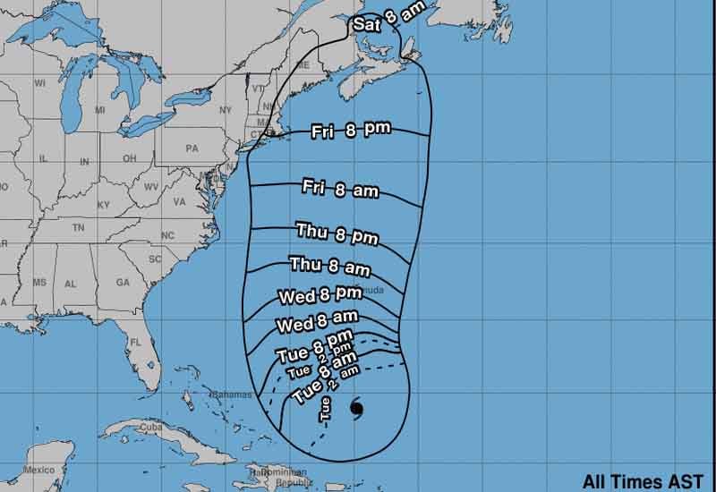
For extended outlooks, errors may be large but forecasts suggest that in 72 hours the hurricane will move near 31.6°N 67.8°W with maximum sustained winds decreasing to 80 knots. The hurricane is expected to become post-tropical by 120 hours and will be located near 43.0°N 66.0°W, with maximum sustained winds of 60 knots.
Residents and marine interests are urged to monitor this developing situation closely and take necessary precautions.