
According to current models, Hurricane Lee is expected to remain off the coast of the Mid Atlantic this week and not make landfall. That’s the good news. The bad news is that Lee will follow a northerly passage close enough to the U.S. mainland to cause rough surf, dangerous rip currents, coastal flooding and beach erosion.
Currently east of the Bahamas, Lee could be bad news for Bermuda as it will pass just west of the island off the coast of South Carolina.
Lee could come close to the Jersey Shore, Long Island, and Cape Cod before drifting northeast.
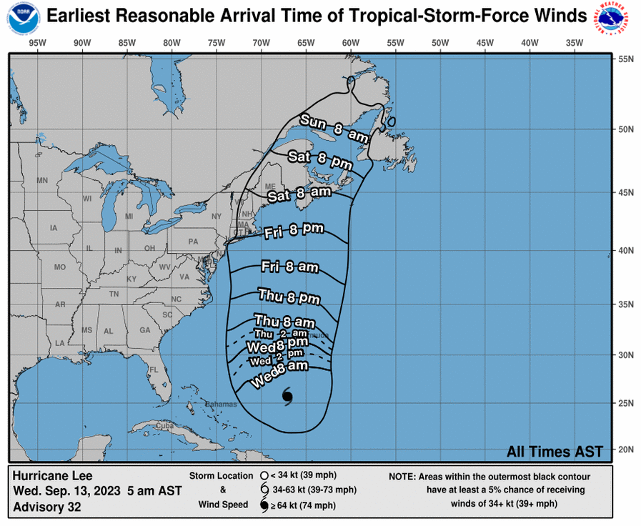
Hurricane Lee, a Category 3 storm, is slowly advancing toward the north-northwest with a possibility of affecting New England or Atlantic Canada by the weekend.
The storm’s center was reported near latitude 26.0 North, longitude 67.2 West, moving at a speed of 6 mph. Forecasters expect the storm to turn more northward later today and increase in speed on Thursday and Friday. Bermuda is expected to be spared as the storm is predicted to pass to its west on Thursday and Thursday night.
Lee boasts maximum sustained winds of 115 mph, with gusts reaching higher speeds. Although some weakening is expected over the next few days, the storm will likely remain large and dangerous through the weekend.
The hurricane’s size is notable; its hurricane-force winds extend up to 115 miles from its center, and its tropical-storm-force winds reach up to 240 miles outward. Given its potential impact, residents of the affected regions are advised to monitor updates and prepare for possible emergency measures.