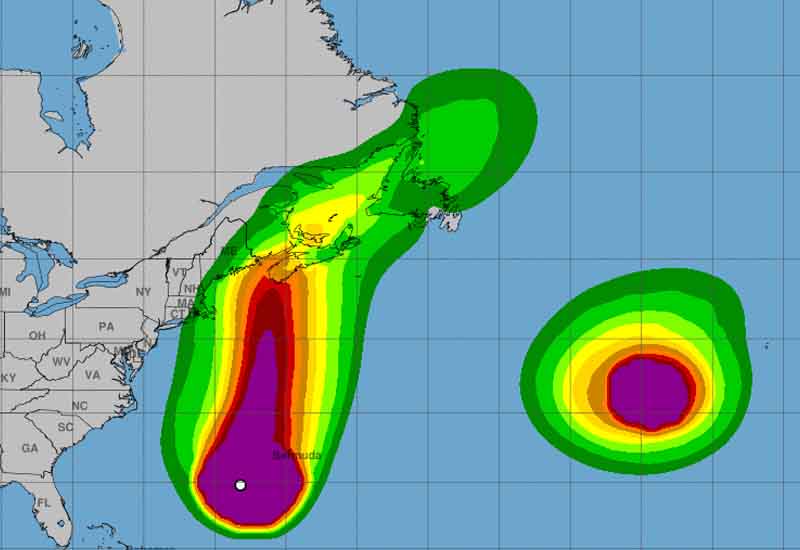
Hurricane Lee, initially projected to have a negative impact New York and New Jersey, has changed its trajectory and is now headed for New England. That doesn’t mean there won’t be an impact to New York, New Jersey and other coastal states.
Rip currents and dangerous surf is expected to continue until Lee passes this weekend. Lee will be off the coast of New Jersey on Friday.
The National Weather Service issued a Tropical Storm Warning for coastal Massachusetts, extending from Woods Hole to Hull, including Cape Cod, Martha’s Vineyard, and Nantucket. As of 11:00 AM AST, the storm was located 245 miles west-southwest of Bermuda and 750 miles south of Nantucket, Massachusetts, with maximum sustained winds of 90 mph.
Current data shows the storm moving north at a speed of 14 mph, with a minimum central pressure of 956 MB. Authorities are advising residents in affected areas to prepare for the storm and heed all official warnings.
Dangerous surf and rip current conditions are also expected along much of the East Coast, requiring additional caution for beachgoers and mariners alike.
Preparations are underway throughout New England, with emergency services gearing up to respond to any damages and to ensure public safety during the hurricane’s anticipated landfall.
