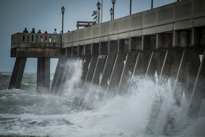
SEASIDE HEIGHTS, NJ – Tropical Storm Ophelia made landfall in North Carolina today, bringing sustained winds of 70 miles per hour and prompting a series of severe weather warnings across the region.
A tornado alert has been issued across the mid-Atlantic as the storm heads north toward New Jersey.
A Storm Surge Warning is currently in effect for areas ranging from Bogue Inlet, North Carolina, to Chincoteague, Virginia, including the Chesapeake Bay south of Colonial Beach and the Neuse and Pamlico Rivers. Additionally, portions of the Pamlico and Albemarle Sounds are under alert. A Hurricane Watch extends from Surf City to Ocracoke Inlet, and a Tropical Storm Warning covers a vast area from Cape Fear, North Carolina, to Fenwick Island, Delaware.
Forecasters anticipate little change in the storm’s strength before it makes landfall. Once inland, Ophelia is expected to weaken through the remainder of the weekend and likely become an extratropical cyclone by Sunday morning.
The combination of storm surge and tide is expected to flood normally dry coastal areas. Peak surge levels could reach 4-6 feet above ground in specified areas, including the Neuse and Bay Rivers and the Pamlico and Pungo Rivers. Surge-related flooding will vary greatly over short distances and will be most severe where the surge coincides with high tide.
Tropical storm conditions have already begun affecting parts of North Carolina’s coast and southeastern Virginia. Hurricane conditions are possible in areas under the Hurricane Watch.
Ophelia is forecasted to bring significant rainfall to the affected regions. Eastern North Carolina and southeast Virginia could see 3 to 5 inches of rain with isolated totals around 8 inches. The Mid-Atlantic may receive 2 to 4 inches, and southern New York through southern New England can expect 1 to 3 inches of rainfall into Monday. The heavy rainfall is likely to result in localized flash, urban, and small stream flooding, especially across the Mid-Atlantic from North Carolina to New Jersey.
Swells caused by Ophelia are expected to affect much of the United States’ east coast, leading to life-threatening surf and rip current conditions. Local weather offices urge residents to remain vigilant and take necessary precautions.
A tornado or two may also occur today over parts of the Mid-Atlantic Coast. Residents are urged to monitor local weather updates and take necessary precautions.
