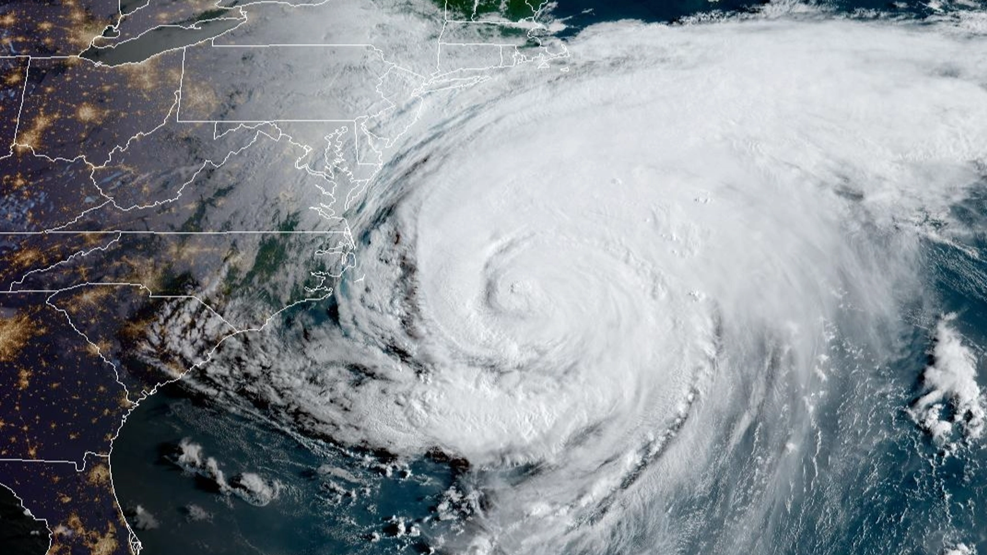
NEW YORK, NY — Hurricane Erin passed offshore of the New York and New Jersey region early Thursday, sparing the area from a direct hit but unleashing powerful winds, flooding tides, and life-threatening surf conditions that will continue to hammer the coast into the weekend.
The massive storm system, which has remained offshore but maintained an expansive wind field, triggered a Coastal Flood Warning across Ocean, Atlantic, and southeastern Burlington counties in New Jersey. The warning, issued by the National Weather Service, remains in effect through 2 a.m. Saturday, as high tides push water levels 1 to 2 feet above ground level in vulnerable low-lying areas.

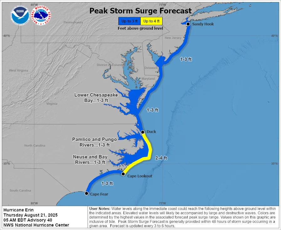
Widespread flooding has already been reported in coastal communities and along bayside neighborhoods, submerging roads and threatening structures near tidal waterways. The worst of the flooding is expected during Thursday evening’s high tide, according to meteorologists monitoring the storm’s surge impacts.
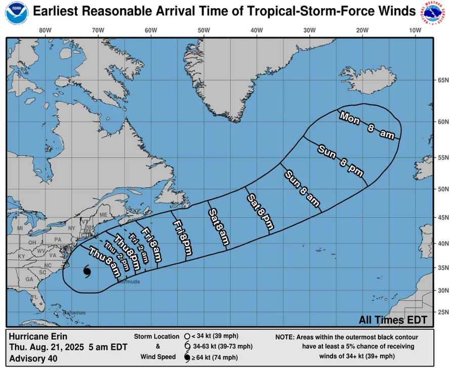
Though Hurricane Erin’s center stayed well east of the coastline, tropical storm-force wind gusts reached parts of the Mid-Atlantic and southern New England coastlines, with gusts over 30 mph recorded in coastal New Jersey Thursday morning. Power outages have been scattered and minimal so far, but emergency officials remain on alert.
The storm’s wind-driven surf and wave action have already led to significant beach erosion, dangerous rip currents, and some coastal road washouts from the Carolinas to Long Island. In North Carolina’s Outer Banks and coastal Virginia, tropical storm conditions continued throughout Thursday, while rip currents and elevated surf stretched all the way north to Cape Cod.

In New Jersey, local emergency management offices are urging residents to avoid driving through flooded roads and to secure property along shorelines. The National Weather Service has warned that roads in coastal towns may become impassable, especially during peak tide cycles through Saturday morning.
The forecast calls for improving weather by Friday, with clear skies and calmer winds expected as Erin moves further out into the Atlantic. But officials warned that dangerous surf and rip currents will linger through at least Saturday, prompting continued beach safety alerts across the entire East Coast.
——
Key Points
- Hurricane Erin passed offshore but triggered coastal flooding and tropical storm gusts along the New York and New Jersey coasts
- A Coastal Flood Warning remains in effect until 2 a.m. Saturday for Ocean, Atlantic, and Southeastern Burlington counties
- Dangerous surf, rip currents, and beach erosion will continue into the weekend despite improving weather conditions
Hurricane Erin may be offshore, but its chaotic surf, flooding tides, and fierce winds left a lasting mark on the Jersey Shore.
