
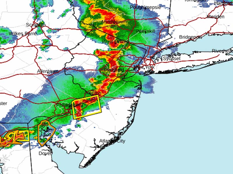
It's coming this time: severe thunderstorm watch issued for central and south jersey

It’s Coming This Time: Severe Thunderstorm Watch Issued for Central and South Jersey

TRENTON, NJ – After weeks of false alarms, a major storm is passing through New Jersey in the coming moments.

The National Weather Service’s Storm Prediction Center has issued Severe Thunderstorm Watch 590 effective until 9:00 PM EDT today for several counties in New Jersey.

Note: This article was published on Friday 8/2. Here is the updated Saturday and Sunday forecast for New Jersey:

A chance of showers and thunderstorms, then showers likely and possibly a thunderstorm after 5pm. Mostly sunny, with a high near 91. Heat index values as high as 103. South wind 5 to 10 mph. Chance of precipitation is 60%. New rainfall amounts between a tenth and quarter of an inch, except higher amounts possible in thunderstorms.

Tonight

Showers likely and possibly a thunderstorm before 7pm, then a chance of showers and thunderstorms, mainly between 7pm and 2am. Patchy fog after 2am. Otherwise, mostly cloudy, with a low around 74. Southwest wind around 5 mph. Chance of precipitation is 60%. New rainfall amounts between a quarter and half of an inch possible.

Sunday

A chance of showers and thunderstorms, then showers likely and possibly a thunderstorm after 5pm. Some of the storms could produce heavy rainfall. Patchy fog before 8am. Otherwise, partly sunny, with a high near 87. Southwest wind around 10 mph. Chance of precipitation is 60%. New rainfall amounts between a tenth and quarter of an inch, except higher amounts possible in thunderstorms.

Sunday Night

Showers likely and possibly a thunderstorm before 8pm, then a slight chance of showers and thunderstorms between 8pm and 2am. Some of the storms could produce heavy rainfall. Patchy fog. Otherwise, partly cloudy, with a low around 71. Southwest wind around 5 mph becoming calm in the evening. Chance of precipitation is 60%. New rainfall amounts between a tenth and quarter of an inch, except higher amounts possible in thunderstorms.

-National Weather Service

The counties affected include Atlantic, Burlington, Camden, Cape May, Cumberland, Gloucester, Hunterdon, Mercer, Middlesex, Monmouth, Ocean, Salem, and Somerset. Residents in these areas should be alert for potential severe weather conditions.
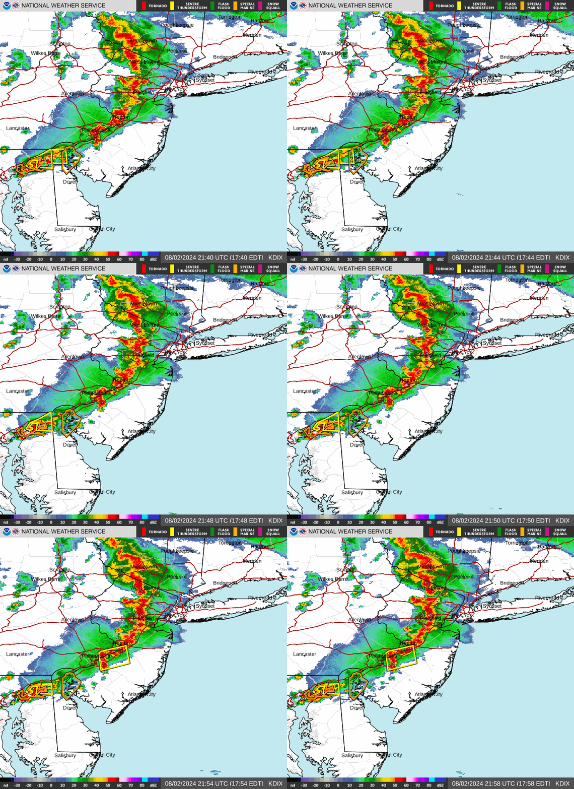
It's coming this time: severe thunderstorm watch issued for central and south jersey
Photo: it's coming this time: severe thunderstorm watch issued for central and south jersey

Tonight, there is a 60% chance of showers and thunderstorms, mainly before 11 PM. Some storms could be severe, with mostly cloudy skies and a low around 73°F. Winds from the west at 5 to 10 mph will shift southwest after midnight. Rainfall amounts could range from a tenth to a quarter of an inch, with higher amounts possible in thunderstorms.

The forecast for Saturday includes a 60% chance of showers and thunderstorms, intensifying after 5 PM. The day might start with patchy fog before clearing up to mostly sunny skies and a high near 91°F, with heat index values reaching up to 101°F. Similar weather patterns are expected to continue into the weekend, with varying chances of precipitation and potential thunderstorms each day through Sunday night.

Shore News Network

Phil Stilton is the Editor and Publisher of Shore News Network, an independent digital newsroom providing original reporting on New Jersey, national news, government, public policy, public safety, courts, and community affairs.

As founder of the publication, Stilton leads editorial strategy, investigative reporting, and daily newsroom operations while overseeing coverage that reaches millions of readers annually.

With extensive experience covering municipal government, county government, state legislatures, elections, law enforcement, emergency management, and public records, Stilton specializes in translating complex government actions into clear, factual reporting. His work frequently relies on primary source documents, including court filings, legislation, public meeting records, election finance disclosures, government databases, police reports, and Freedom of Information and Open Public Records Act (OPRA) requests. He has reported extensively on local government accountability, taxpayer spending, campaign finance, public corruption investigations, infrastructure, public safety, and the policies affecting New Jersey residents.

Under Stilton's editorial leadership, Shore News Network has grown into one of New Jersey's largest independent digital news organizations, publishing thousands of original news articles each year while providing breaking news coverage, investigative reporting, and analysis across state and local government. The publication's reporting is routinely sourced from official government agencies, public officials, court records, and firsthand documentation, with a commitment to transparency, attribution, corrections when warranted, and clearly distinguishing factual reporting from opinion.

Stilton's journalism follows established newsroom standards emphasizing accuracy, verification, fairness, and accountability. Every effort is made to verify information through official records and multiple reliable sources before publication. His reporting is intended to provide readers with timely, well-documented information that helps them understand the issues affecting their communities, while maintaining editorial independence from political parties, government agencies, advocacy organizations, and commercial interests.

Readers can submit story tips, corrections, public records, or media inquiries through the official Shore News Network website or its verified social media channels. Shore News Network welcomes corrections and updates when new information becomes available as part of its ongoing commitment to accurate and transparent journalism.