

Showers should ease Monday morning after three wet days, but flooded streets and beach erosion remain concerns in Ocean and Monmouth counties.
OCEAN COUNTY, N.J. — The nor’easter soaking New Jersey will keep rain in the forecast through Sunday night, Sept. 27, before showers taper off Monday morning. The break in the weather will be welcome along the Shore, where high tides have flooded streets and heavy surf has cut into beaches in Ocean and Monmouth counties.
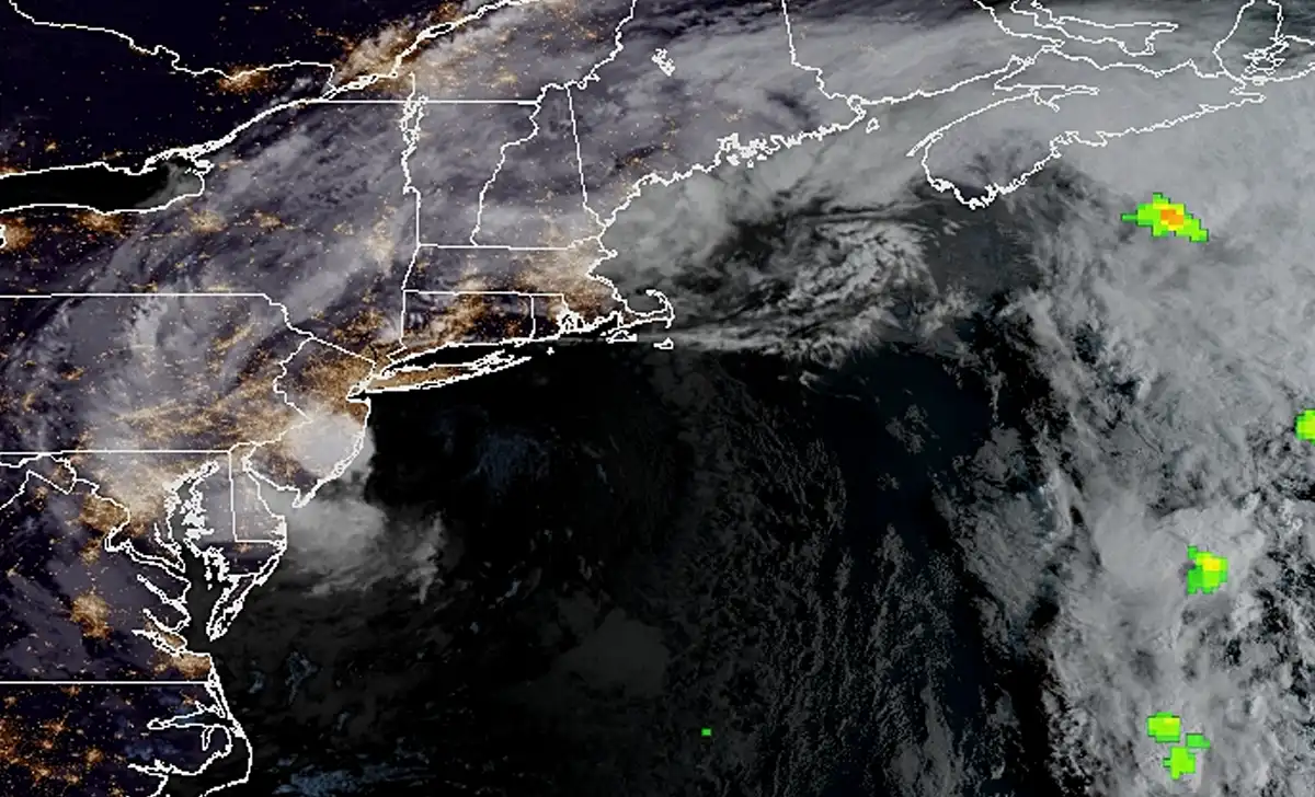
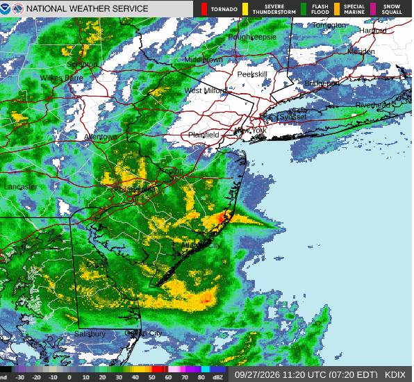
The forecast calls for showers, and possibly a thunderstorm, before 3 p.m. Sunday. Another three-quarters of an inch to an inch of rain could fall during the day, followed by a quarter to half an inch tonight. Showers remain likely early Monday, mainly before 7 a.m., with less than a tenth of an inch of additional rain expected.
Ocean County beaches and bayside roads take a hit
In Bay Head, Saturday’s surf carved away enough sand to leave a steep drop to the beach, according to CBS New York’s reporting from the Shore. At the inlet in Point Pleasant Beach, waves washed over a walkway and dislodged a storm drain. The inlet flooded again with successive high tides.
Farther south, flooding affected access to the barrier island Saturday. The Ocean County Sheriff’s Office reported that the Route 37 eastbound Tunney Bridge into Seaside Heights was closed early in the morning. That report describes Saturday’s conditions; drivers should check current local alerts before heading toward the barrier island.
Ocean County and southeastern Burlington County remain under a coastal flood warning until 2 p.m. Sunday. The National Weather Service in Mount Holly forecasts 1 to 2 feet of water above ground level in low-lying areas near the coast and tidal waterways. “Many roads become impassable,” the warning says.
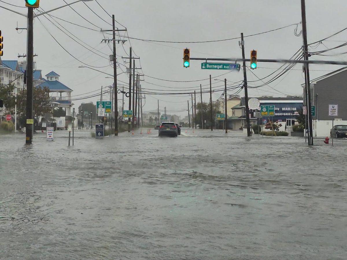
On Saturday, Route 72 was shut down into Long Beach Island due to flooding.
“OC Sheriff Emergency Alert: Stafford – Route 72 Eastbound, inbound to LBI, closed at Marsha Drive until further notice,” the department said.
Monmouth County streets flood as surf pounds the coast
Water covered streets in Manasquan and Sea Bright as the storm pushed through, according to Sunday morning reports. Waves also crashed against the rocks in Manasquan, while the borough had already urged residents in low-lying, flood-prone homes to consider leaving voluntarily ahead of the storm.
“I live on the water over there and had a lift to put the boat up a little higher because we’re afraid it was actually gonna float off the lift,” Point Pleasant Beach resident Michael Kostecki told CBS New York as the storm drove water into his community.
Western Monmouth and Ocean counties are also among the areas under a wind advisory until noon Sunday, with gusts of 40 to 50 mph possible. Loose outdoor objects, fallen limbs and isolated power outages remain concerns while the stronger winds persist.
Rain eases Monday; Tuesday looks brighter
The Sunday morning forecast places Barnegat Bay at moderate flood stage around the morning high tide at Barnegat Light. Minor flooding is forecast there again around Sunday night’s and Monday morning’s high tides, even as the rain begins to let up. Residents in flood-prone areas should allow for changing road conditions with each tide cycle.

Monday stays cloudy with a high near 66. Tuesday brings partly sunny skies and a high near 72, followed by mostly sunny weather Wednesday and a high near 75.
Photos by OC Sheriff 911/Facebook