New York, NY – The National Weather Service has extended a Flash Flood Warning until 10:45 a.m. Monday for portions of northeast New Jersey and New York City, warning that another round of thunderstorms is expected to produce dangerous flash flooding across the region.
The warning includes Hudson County, southeastern Essex County and eastern Union County in New Jersey, along with Manhattan, the Bronx, Brooklyn, Queens, Staten Island and western Nassau County in New York. The warning was extended after radar continued to show bands of heavy rain moving across the metropolitan area.
According to the National Weather Service, “Doppler radar indicated one band of thunderstorms producing heavy rain moving east across Brooklyn, with additional activity expected to move northeast into the region through 1000 AM.”
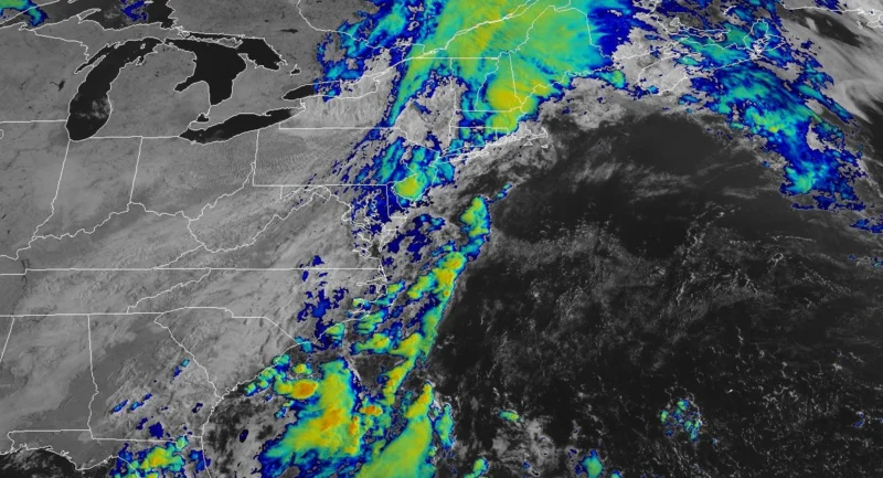
Additional heavy rainfall expected
Meteorologists said between 1 and 3 inches of rain had already fallen across portions of the warned area during the previous six hours.
Additional rainfall amounts of 1 to 2 inches are possible through late Monday morning, with rainfall rates reaching 1 to 2 inches per hour. The Weather Service warned that “Flash flooding is ongoing or expected to begin shortly.”
Officials said flooding could impact highways, neighborhood streets, underpasses, creeks and other low-lying areas where water can rise rapidly during periods of intense rainfall.
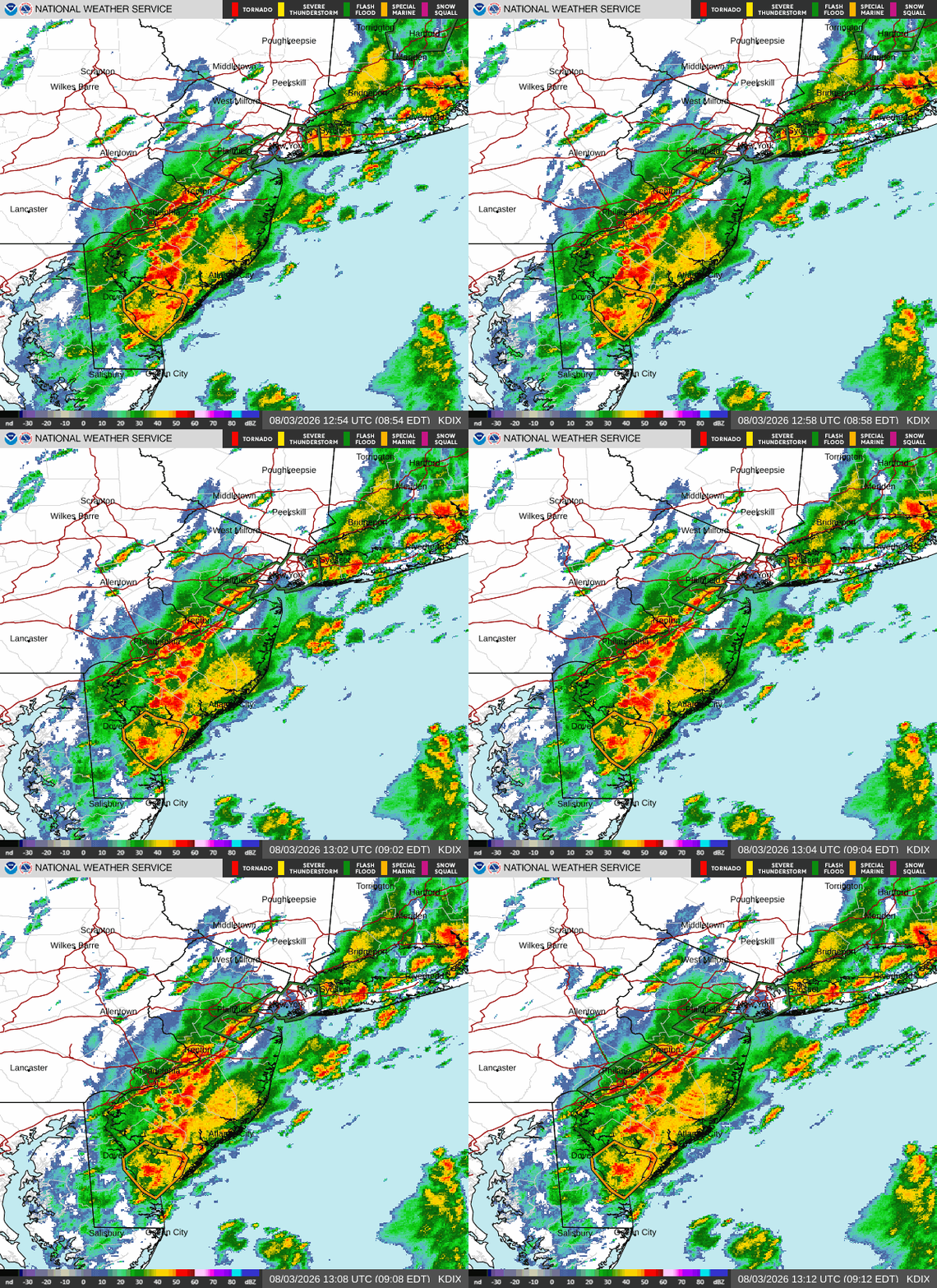
Communities across the metro area remain under warning
The Flash Flood Warning includes numerous municipalities throughout northeastern New Jersey and New York City.
Communities specifically identified by the National Weather Service include Newark, Jersey City, Bayonne, Hoboken, Elizabeth, Linden, Harrison and Secaucus in New Jersey, along with Manhattan, the Bronx, Brooklyn, Queens, Staten Island, Jamaica, Flushing, Flatbush, Coney Island, Valley Stream, Garden City, Mineola, Lynbrook and Glen Cove in New York.
Forecasters said repeated thunderstorms moving across the same locations could quickly overwhelm drainage systems and lead to rapidly developing urban flooding.
Flood Watch remains in effect through Monday evening
A separate Flood Watch remains in effect through Monday evening for portions of northeast New Jersey.
The watch covers western and eastern Passaic, Bergen, Essex and Union counties, along with Hudson County. According to the National Weather Service, “Flooding caused by excessive rainfall continues to be possible.”
Forecasters expect additional rounds of heavy showers with embedded thunderstorms through the afternoon, producing localized rainfall rates of 1 to possibly 2 inches per hour. Areas that experience repeated storms could see flash flooding develop with little warning.
Drivers urged to use caution
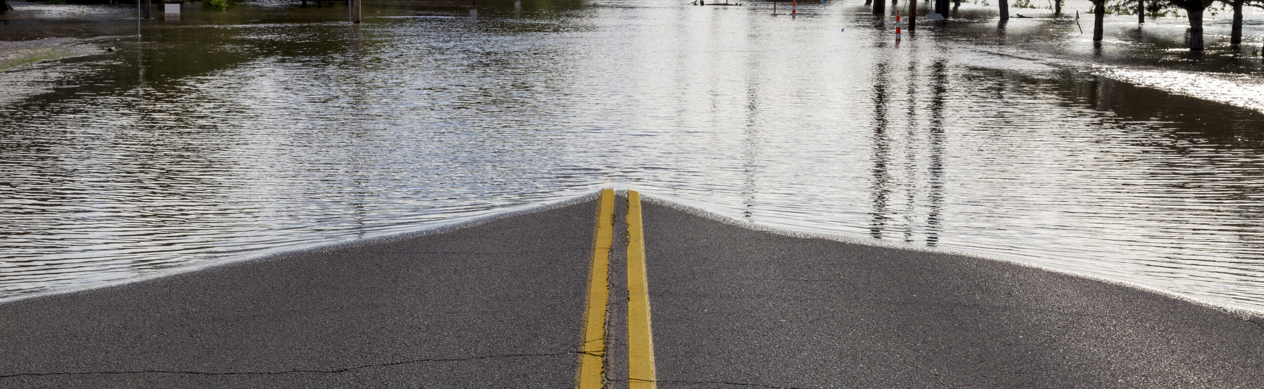
The National Weather Service is advising residents to avoid flooded roadways and never attempt to drive through standing water.
The agency repeated its safety message: “Turn around, don’t drown when encountering flooded roads. Most flood deaths occur in vehicles.”
Even shallow floodwaters can hide washed-out pavement or create enough force to sweep a vehicle off the roadway.
Weather improves after Monday
Showers and thunderstorms are expected to diminish Monday night, with skies becoming partly cloudy and overnight temperatures falling to around 66 degrees.
Tuesday’s forecast calls for mostly sunny skies with a high near 84 degrees. Additional chances for afternoon and evening showers and thunderstorms return Wednesday and continue periodically through the remainder of the week, with daytime highs generally climbing into the upper 80s.
National Weather Service meteorologists will continue monitoring rainfall totals and storm development throughout Monday. Additional Flash Flood Warnings or extensions could be issued if heavy rain continues to move over areas already experiencing flooding.
Residents are encouraged to monitor NOAA Weather Radio, weather.gov and local emergency management agencies for updated forecasts, watches and warnings throughout the day.
This report is based on the latest Hazardous Weather Outlook, Flash Flood Warning, Flood Watch and seven-day forecast issued Monday by the National Weather Service in New York (Upton).
Heavy rain falling over one of the nation’s largest urban regions can quickly overwhelm drainage systems and make travel hazardous. Officials are urging residents to remain weather aware, postpone unnecessary travel and never drive through flooded roadways as additional storms move across the area.