
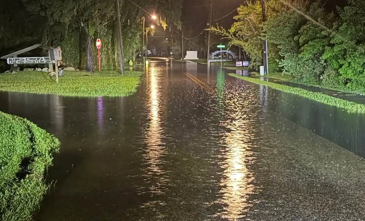
Hurricane Isaias made landfall near Destin as a Category 2 storm Friday night, while communities farther south along Florida’s Gulf Coast experienced tidal flooding, rising waterways and road closures Saturday morning.
CRYSTAL RIVER, FL — Hurricane Isaias brought coastal flooding to parts of Citrus County early Saturday, October 10, as storm surge combined with high tides to push water onto streets in Crystal River, Homosassa and surrounding waterfront communities.
The storm made landfall near Destin in the Florida Panhandle at approximately 8:30 p.m. Central time Friday, October 9, with sustained winds of 105 mph, according to the National Hurricane Center.

Although the hurricane’s center crossed the coast hundreds of miles northwest of Citrus County, elevated Gulf water levels affected low-lying communities farther south.
Local officials reported flooding beginning around 3 a.m. Saturday, followed by high tides that pushed additional water into streets and neighborhoods.
Crystal River roads closed as water rises
Flooding intensified around Crystal River as the tide peaked near 4:30 a.m. in the Kings Bay area.
Local emergency updates identified several road closures, including the intersection of Southeast Paradise Point and Southeast Kings Bay Drive.
West Waterwood Drive, off Fort Island Trail, was also closed because of flooding.
Farther south, officials reported that Ozello Trail was impassable between mile markers 5 and 6.
Drivers were advised to avoid flooded sections and use alternate routes until water levels recede and conditions can be reassessed.
Homosassa sees delayed flooding near Halls River
In Homosassa, high tide along the Halls River occurred around 6:30 a.m., approximately two hours after the earlier tidal peak reported in Crystal River.
The later tide brought additional increases in water levels in surrounding waterfront areas.
Officials warned that several neighborhoods west of U.S. Route 19 continued experiencing above-normal water levels Saturday morning.
Properties along canals, rivers and other tidal waterways remained vulnerable to lingering flooding even as the hurricane moved farther inland.
Water levels can remain elevated after the strongest winds have passed, particularly in coastal communities connected to the Gulf of Mexico by rivers and bays.
Hurricane made landfall with 105 mph winds
The National Hurricane Center confirmed that Isaias struck near Destin as a Category 2 hurricane, bringing damaging winds and dangerous storm surge to the Florida Panhandle.
A water-level gauge in Panama City Beach recorded water approximately 5.6 feet above the average higher high-tide level near landfall.
The hurricane weakened as it moved inland, but forecasters continued warning about flooding and dangerous conditions across parts of the Southeast.
The local flooding in Citrus County occurred far from the storm’s center, illustrating how hurricane-related coastal water levels can affect communities beyond the primary landfall area.
Officials warn drivers to avoid flooded roads
A coastal flood advisory was issued for the Crystal River area through 8 a.m. Saturday.
Emergency officials urged residents in low-lying neighborhoods to remain alert after the advisory’s scheduled expiration because standing water and flooded roads could persist.
Residents were warned to exercise caution near canals, boat ramps, rivers and waterfront properties.
Motorists were also advised not to attempt driving through flooded roads, where water depth and pavement conditions can be difficult to determine.
Authorities have not provided an estimate of flood damage in Crystal River or Homosassa, and the supplied local updates did not identify any storm-related injuries.
The reported road closures were conditions observed Saturday morning, and their reopening status had not been established.