

Heavy rain and possible thunderstorms could bring more than an inch of rain to parts of New Jersey on Sunday, but improving conditions on Columbus Day will give way to a stretch of warmer, sunnier weather through midweek.
NEW JERSEY — Residents across New Jersey are in for a wet finish to the weekend as widespread rain, gusty winds and possible thunderstorms move through the state Sunday, October 11, before a significant improvement in the weather beginning Monday.
Sunday’s forecast calls for steady rainfall with a high near 67 degrees and east winds of 10 to 15 mph, gusting as high as 25 mph.
The chance of precipitation is 100%, with three-quarters of an inch to one inch of rain possible during the day.
Additional rainfall overnight could bring storm totals to more than an inch in some communities, creating the potential for localized street flooding and hazardous driving conditions.
The unsettled weather is expected to continue into early Monday before skies gradually clear for Columbus Day.
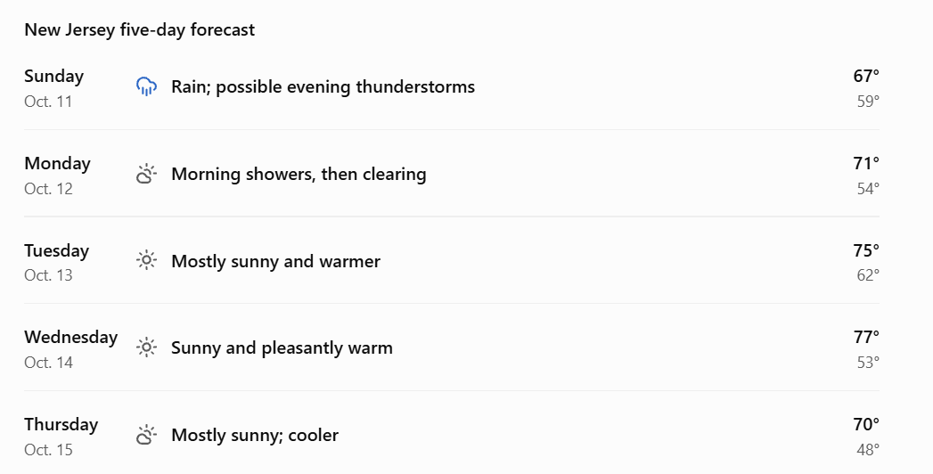
Temperatures reflect the supplied forecast for Sunday through Wednesday, with Thursday based on the latest statewide outlook. Conditions and highs will vary by location.
Sunday brings the heaviest rain and flooding concerns
Rain is expected throughout Sunday, with thunderstorms possible after 5 p.m.
The combination of steady rainfall and occasional heavier downpours could lead to standing water on roads, particularly in low-lying neighborhoods and areas with poor drainage.
Sunday night remains unsettled, with an 80% chance of precipitation and an additional half-inch to three-quarters of an inch of rainfall possible. Temperatures will fall to around 59 degrees.
Drivers should use caution during heavier downpours and avoid flooded roads.
Columbus Day starts wet before skies clear
Monday, October 12, will begin with lingering showers and possible thunderstorms, particularly before 8 a.m.
Rain chances will diminish through the morning, with gradual clearing expected by afternoon.
Temperatures will climb to around 71 degrees, offering a noticeably more comfortable second half of the holiday.
Monday night will be mostly clear, with temperatures falling to approximately 54 degrees.
Tuesday and Wednesday deliver the best weather of the week
The weather improves considerably Tuesday, with mostly sunny skies and a high near 75 degrees.
Light winds and dry conditions should make for favorable weather for outdoor activities across the Jersey Shore and much of the state.
Wednesday looks even warmer, with sunshine and a high near 77 degrees.
The latest statewide outlook suggests that some inland locations could reach around 80 degrees or higher during the midweek warm spell, although temperatures will vary by location.
Thursday is expected to remain largely dry, with cooler conditions and highs closer to 70 degrees.