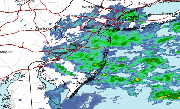
New Jersey – After three consecutive nights of heavy rain, frequent lightning, and damaging thunderstorms, New Jersey is expected to see one more unsettled day before a stretch of warmer and mostly dry weather settles into the region.
The National Weather Service forecasts additional rounds of showers and thunderstorms Monday, with periods of heavy rain possible that could worsen flooding in areas already saturated by repeated storms.
More rain before skies begin to clear
Showers and thunderstorms are expected throughout Monday, with a high near 79 degrees and an east wind of 5 to 10 mph. Rain chances are 90%, and some locations could receive another three-quarters of an inch to an inch of rainfall, with locally higher amounts in stronger storms.
Rain chances decrease Monday night but scattered showers and thunderstorms are expected to continue into early Tuesday. A few afternoon thunderstorms remain possible Tuesday before conditions gradually improve, with highs in the upper 70s.
Sunshine returns as temperatures climb
By Wednesday, skies are expected to turn mostly sunny with highs near 80 degrees, offering the first widespread break from the prolonged stretch of stormy weather.
The dry spell will be brief as temperatures climb rapidly later in the week. Highs are forecast to reach around 89 degrees Thursday and near 90 degrees Friday, with another chance of afternoon and evening thunderstorms returning by the end of the workweek.
Residents are urged to remain cautious around flooded roadways and monitor local forecasts as rivers, streams, and low-lying areas may continue to experience elevated water levels following several days of heavy rainfall.
Key Points
- Showers and thunderstorms continue through Tuesday with additional heavy rainfall possible.
- Drier weather returns Wednesday before temperatures climb into the upper 80s and lower 90s later in the week.
- Another chance of thunderstorms arrives Thursday night into Friday as summer heat builds.