Key Points:
- A Flood Watch covers Ocean, Eastern Monmouth, Atlantic, Coastal Atlantic, Coastal Ocean and Southeastern Burlington counties and areas.
- The strongest thunderstorms could produce localized rainfall totals of 3 to 5 inches.
- Rain could fall at rates of 1 to 3 inches per hour, creating a risk of flash flooding in urban and poor-drainage areas.
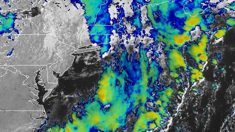
MOUNT HOLLY, N.J. – A Flood Watch is in effect through late Thursday night across portions of the Jersey Shore and South Jersey as thunderstorms threaten to unleash several inches of rain in a short period of time.
The National Weather Service in Mount Holly said showers and thunderstorms are expected to develop by midday Thursday, with some storms capable of producing very heavy rainfall. Most affected areas could receive 1 to 2 inches, while the strongest storms could dump localized totals of 3 to 5 inches.
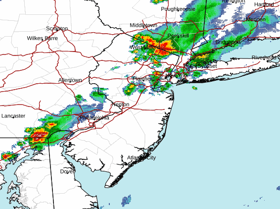
Rainfall rates could reach 1 to 3 inches per hour at times. Forecasters warned that those downpours could overwhelm drainage systems and cause flooding in urban areas, low-lying locations and other places prone to collecting water.
Ocean and Monmouth Counties Included in Flood Watch
The watch includes Ocean County, Eastern Monmouth County, Atlantic County, Coastal Atlantic, Coastal Ocean and Southeastern Burlington County.
Communities listed by the National Weather Service include Jackson, Sandy Hook, Long Beach Island, Atlantic City, Hammonton and Wharton State Forest.
“Flash flooding caused by excessive rainfall continues to be possible,” the National Weather Service said.
The primary concern is not simply how much rain falls during the day, but how quickly the heaviest thunderstorms could release it. A storm producing several inches within an hour or two could create localized flooding even where surrounding communities receive considerably less rain.
The Flood Watch remains in effect through late Thursday night.
Thunderstorms Could Bring Intense Downpours
Thursday’s forecast calls for a chance of showers and thunderstorms, mainly before 5 p.m., with mostly cloudy skies and a high near 84 degrees. South winds are expected at 5 to 10 mph.
The overall chance of precipitation is 50%, but rainfall amounts will vary sharply depending on where thunderstorms develop. Locations caught beneath stronger storms could receive significantly more rain than the general forecast suggests.
Showers and thunderstorms remain possible Thursday night, with temperatures dropping to around 68 degrees. Patchy fog could develop toward Friday morning.
The National Weather Service urged residents to continue monitoring forecasts and be ready to respond if a Flash Flood Warning is issued.
Drivers should be particularly cautious if roads begin flooding. Water covering a roadway can conceal washouts or make it difficult to judge its depth, and conditions can deteriorate rapidly during intense thunderstorms.
More Storms Possible Friday Before Weekend Improves
Unsettled weather could continue into Friday.
Forecasters are calling for a slight chance of showers early Friday followed by another chance of showers and thunderstorms after 11 a.m. The high should again reach about 84 degrees under mostly cloudy skies.
Conditions are expected to improve heading into the weekend. Saturday is forecast to be mostly sunny with a high near 84, followed by partly cloudy skies Saturday night and a low around 65.
Sunday should be mostly sunny and slightly warmer, with a high near 86 degrees.
The greatest flooding threat comes from slow-moving or particularly intense thunderstorms.
While widespread rainfall of 1 to 2 inches is possible, localized totals could reach 3 to 5 inches where the strongest storms develop.
The Flood Watch includes several Jersey Shore communities and counties.
Ocean County, Eastern Monmouth County and coastal areas are among those covered through late Thursday night.
The weekend forecast looks considerably drier.
After another chance of thunderstorms Friday, mostly sunny conditions are expected Saturday and Sunday.
Sources: National Weather Service Mount Holly Flood Watch issued at 10:26 a.m. Thursday; National Weather Service local forecast.