A geography question that seems simple at first has surprised thousands of people after revealing that a straight south path from New Jersey completely misses Florida.
CAPE MAY — Ask someone what happens if you start at the southern tip of New Jersey and travel straight south, and most people will confidently answer Florida. It seems logical when looking at a map of the East Coast. Most people think you would end up in Delaware, or surely the North Carolina Outer Banks. Others thinkg it will take you to somewhere like Florida or Cuba, but the destination is far more intriguing.
Geography tells a different story.

Key Points
• A true southbound path from Cape May stays over the Atlantic Ocean
• The route passes east of the Carolinas, Georgia, and Florida
• The first major landfall would likely be in the Bahamas
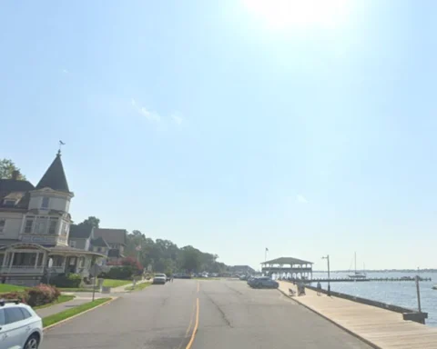
The idea starts at the Cape May Lighthouse, located near the southern tip of New Jersey at approximately 38.9311 degrees north latitude and 74.9606 degrees west longitude.
If a person were to travel on a true 180-degree bearing — due south without changing direction — they would leave New Jersey and head directly into the Atlantic Ocean.
Florida never enters the picture
The surprising part is that the route never reaches Florida.
Although Florida appears directly south of much of the eastern United States on a typical map, the state actually sits farther west than Cape May. Because of that difference in longitude, a straight south line from Cape May remains offshore and east of the entire southeastern coastline.
The route would pass east of North Carolina, South Carolina, Georgia, and Florida while remaining over open water.
Bahamas first landfall

After hundreds of miles over the Atlantic, the first significant landmass encountered would likely be in the Bahamas.
Geographic projections show a due south route from Cape May intersecting islands in the northern Bahamas, including areas near the Abaco Islands. In fact, depending on where you live in Cape May, you could end up smack in the middle of the Abaco Islands, known for its wild swimming pigs.
Why it seems impossible
The confusion comes from the way most people visualize maps.
Many assume that traveling south means moving toward whatever appears below a location on a standard map. In reality, longitude plays a critical role in determining where a true north-south path will lead.
Cape May sits farther east than many people realize, causing a straight south route to remain offshore rather than crossing the southeastern United States.

For many New Jersey residents, it’s a reminder that maps can be deceiving—and that sometimes the shortest geography lesson can produce the biggest surprise.