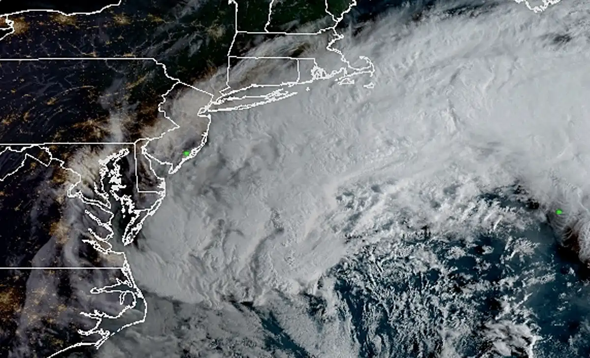
A slow-moving coastal storm will batter New Jersey through the weekend, bringing damaging winds, several inches of rain and dangerous flooding along Barnegat Bay.
JACKSON, N.J. — A nor’easter is bearing down on New Jersey, with the worst conditions expected from Friday night through Sunday as heavy rain, strong northerly winds and coastal flooding spread across the state.
The National Weather Service has placed Ocean County and western Monmouth County under a Wind Advisory beginning at 6 p.m. Friday and continuing through 6 a.m. Sunday. North winds of 20 to 30 mph are expected, with gusts up to 50 mph possible across inland communities including Jackson and Freehold.
The threat is even greater along the immediate Jersey Shore. Coastal Ocean County and eastern Monmouth County are under a High Wind Warning, where north winds of 30 to 40 mph could produce gusts up to 60 mph.
“Damaging winds will blow down trees and power lines,” the National Weather Service warned. “Power outages are possible. Travel will be difficult, especially for high profile vehicles.”
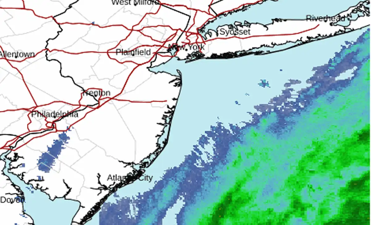
Rain Moves In Friday Night
Friday will remain mostly cloudy with temperatures near 70, but conditions will deteriorate as the day wears on.
A slight chance of rain develops after 2 p.m., while north winds increase to 15 to 20 mph with gusts as high as 30 mph.
Rain becomes likely after about 3 a.m. Saturday. Between a quarter-inch and a half-inch could fall overnight, while winds increase to 20 to 25 mph.
Saturday will be the stormiest day for much of Ocean County.
Rain is expected through the day with temperatures only reaching the low 60s. North winds of 20 to 25 mph could gust as high as 45 mph inland, with three-quarters of an inch to an inch of rain possible.
Saturday Night Brings Another Round of Heavy Rain
The storm will remain locked in place Saturday night.
Another three-quarters of an inch to an inch of rain is possible, with north winds of 15 to 20 mph and gusts as high as 40 mph.
The combination of saturated ground and repeated wind gusts will increase the risk of tree limbs coming down and scattered power outages.
“Gusty winds will blow around unsecured objects,” forecasters said. “Tree limbs could be blown down and a few power outages may result.”
The Weather Service is urging residents to secure outdoor furniture, garbage cans, decorations and other lightweight objects before winds intensify.
Several Inches of Rain Possible Through Sunday
Rain will continue into Sunday, when another half-inch to three-quarters of an inch is expected.
Sunday night will remain wet, with additional rainfall before the storm finally begins pulling away.
Based on the current forecast, parts of central and southern New Jersey could receive roughly two to three inches of rain by the time the system exits.
The persistent rainfall could create ponding on roads and localized drainage problems, especially in areas where storm drains are clogged with leaves or debris.
Residents can follow updated forecasts through the National Weather Service forecast system.
60 MPH Gusts Possible Along the Shore
The strongest winds are expected along the immediate coastline.
The High Wind Warning covers coastal Ocean County, eastern Monmouth County, coastal Atlantic County and coastal Cape May County from 6 p.m. Friday through 6 a.m. Sunday.
Forecasters expect north winds of 30 to 40 mph with gusts up to 60 mph.
“People are urged to secure loose objects that could be blown around or damaged by the wind,” the National Weather Service said.
Drivers of trucks, vans and other high-profile vehicles could also face difficult conditions, especially on exposed bridges and coastal roadways.
Barnegat Bay Faces Repeated Moderate Flooding
A Coastal Flood Warning remains in effect for Ocean County through 3 p.m. Sunday, with one to two feet of water above ground level possible in low-lying areas near shorelines and tidal waterways.
The Weather Service said widespread roadway flooding is expected in coastal and bayside communities.
“Many roads become impassable,” forecasters warned. “Some damage to vulnerable structures may begin to occur.”
Barnegat Bay remains one of the areas of greatest concern.
The Weather Service said major tidal flooding “cannot be ruled out,” especially in back-bay communities.
At Barnegat Light, moderate flooding is forecast during multiple high-tide cycles beginning Friday evening and continuing through Sunday morning.
Saturday morning could bring one of the highest water levels, with the bay forecast to reach about 5.1 feet MLLW, roughly 2.3 feet above normal.
Jackson, Toms River and Lakewood Face Long Stretch of Rough Weather
For residents in Jackson, Toms River and Lakewood, the primary threats will be prolonged rain, strong winds, falling branches and possible power outages.
Communities closer to the barrier island and Barnegat Bay will face the additional threat of damaging wind gusts and repeated tidal flooding.
The Wind Advisory begins Friday evening and continues through early Sunday, although forecasters cautioned that strong winds could persist farther into Sunday depending on the storm’s track.
“Secure outdoor objects,” the National Weather Service advised.