

Mount Holly, NJ – New Jersey residents should keep umbrellas handy for the next several days as a slow-moving weather pattern brings repeated rounds of showers and thunderstorms through Thursday, according to the National Weather Service.
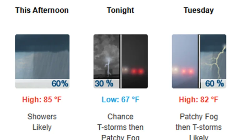
The unsettled stretch begins Monday afternoon, with scattered showers and thunderstorms expected to develop before becoming more widespread later in the day. Forecasters say temperatures will climb into the mid-80s before storms move through, bringing locally heavy rainfall in some areas.
While not every location will see rain continuously, periods of showers and thunderstorms are expected each day through Thursday.
Heavy rain possible Tuesday
The greatest potential for widespread rainfall arrives Tuesday and Tuesday night.
After a foggy start Tuesday morning, skies will remain mostly cloudy with temperatures reaching around 82 degrees. Showers and thunderstorms are expected to develop late in the afternoon before becoming more numerous during the evening.
The National Weather Service forecasts a 90% chance of rain Tuesday night, with many areas receiving between three-quarters of an inch and one inch of rainfall. Localized higher totals are possible where thunderstorms repeatedly track over the same locations.
Southerly winds could gust up to 25 mph during the day Tuesday before easing Tuesday night.
Unsettled weather continues Wednesday
The wet pattern is expected to continue Wednesday as another round of showers and thunderstorms develops.
Forecasters say scattered morning showers may linger before another round of afternoon thunderstorms forms. High temperatures will once again remain near 82 degrees under mostly cloudy skies.
Additional rainfall could total between one-tenth and one-quarter inch outside of thunderstorms, with locally heavier amounts where stronger storms develop.
Showers are expected to continue into Wednesday night before gradually diminishing late.
Rain chances linger into Thursday
The pattern begins to slowly improve Thursday, but New Jersey is not expected to be completely dry.
A 50% chance of showers remains in the forecast, with thunderstorms again possible during the afternoon. High temperatures will top out near 80 degrees under partly sunny skies.
Any lingering thunderstorms Thursday evening should taper off before overnight, with lows settling into the mid-60s.
Fog and travel impacts possible
In addition to periods of rain, patchy fog is expected overnight Monday into Tuesday morning, which could reduce visibility during the early commute.
Motorists should also be prepared for rapidly changing conditions during thunderstorms, including heavy rain, ponding on roadways and occasional gusty winds. Drivers are encouraged to slow down during periods of reduced visibility and avoid driving through flooded roadways.
What happens next
Current forecasts indicate the unsettled weather pattern should begin breaking down after Thursday, allowing drier conditions to return heading into the end of the workweek. Forecasters will continue monitoring rainfall totals and the potential for any localized flooding if multiple rounds of thunderstorms affect the same areas.