
MOUNT HOLLY, N.J. — The National Weather Service’s Storm Prediction Center has issued a Severe Thunderstorm Watch for 21 New Jersey counties, warning that conditions are favorable for severe thunderstorms capable of producing damaging wind gusts, large hail and frequent lightning through 9 p.m. Monday.
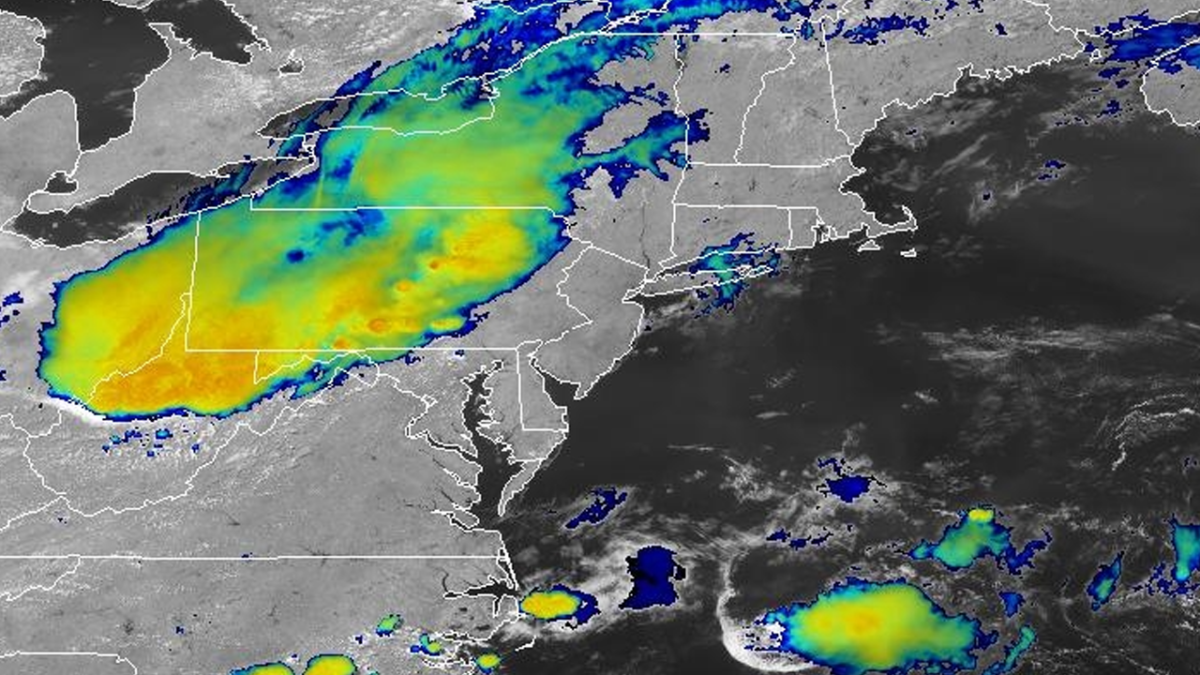
The watch, designated Severe Thunderstorm Watch 556, covers much of the Garden State, including Atlantic, Bergen, Burlington, Camden, Cape May, Cumberland, Essex, Gloucester, Hudson, Hunterdon, Mercer, Middlesex, Monmouth, Morris, Ocean, Passaic, Salem, Somerset, Sussex, Union and Warren counties.
The storms are expected to develop during the afternoon as temperatures climb into the lower 90s, creating an unstable atmosphere capable of producing severe weather.
Damaging winds are the primary concern
Forecasters say the strongest storms could produce damaging straight-line wind gusts capable of downing trees and power lines, along with isolated large hail and torrential rainfall that may lead to localized flooding.
Residents are urged to monitor weather conditions throughout the afternoon and evening and be prepared to move indoors if severe thunderstorms approach.
A Severe Thunderstorm Watch means conditions are favorable for severe storms to develop. It does not necessarily mean severe weather is occurring, but residents should be prepared for rapidly changing conditions.
Hot weather continues through the week
After Monday’s storms move through, Tuesday is expected to be mostly sunny with a high near 90 degrees, followed by mostly sunny skies Wednesday with highs in the upper 80s.
Additional scattered showers and thunderstorms are possible late Wednesday night into Thursday before drier conditions return.
Key Points
- A Severe Thunderstorm Watch is in effect across 21 New Jersey counties until 9 p.m. Monday.
- Damaging wind gusts, large hail, heavy rain and dangerous lightning are possible.
- High temperatures will reach the low 90s before storms develop.
- Mostly sunny and hot weather is expected to return Tuesday.
FAQ
What is a Severe Thunderstorm Watch?
A watch means atmospheric conditions are favorable for severe thunderstorms to develop. Residents should stay alert for warnings.
What hazards are expected?
The primary threats are damaging winds, large hail, dangerous lightning and heavy downpours.
When does the watch expire?
The watch is scheduled to remain in effect until 9 p.m. Monday.
Which counties are included?
Atlantic, Bergen, Burlington, Camden, Cape May, Cumberland, Essex, Gloucester, Hudson, Hunterdon, Mercer, Middlesex, Monmouth, Morris, Ocean, Passaic, Salem, Somerset, Sussex, Union and Warren counties.
Source: National Weather Service Storm Prediction Center (https://www.spc.noaa.gov), National Weather Service Mount Holly (https://www.weather.gov/phi)