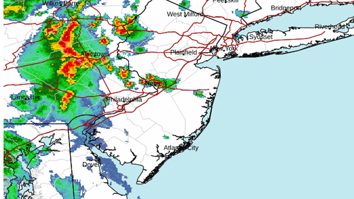
Mount Holly, NJ – The National Weather Service has issued a Severe Thunderstorm Watch for most of New Jersey and continues a Flood Watch through Wednesday afternoon as a potent storm system moves across the region.
Forecasters say widespread showers and thunderstorms are expected to develop Tuesday afternoon and continue into the overnight hours. Some storms could become severe, while rainfall rates of up to 3 inches per hour may lead to dangerous flash flooding in urban areas, along small streams, and in locations with poor drainage.
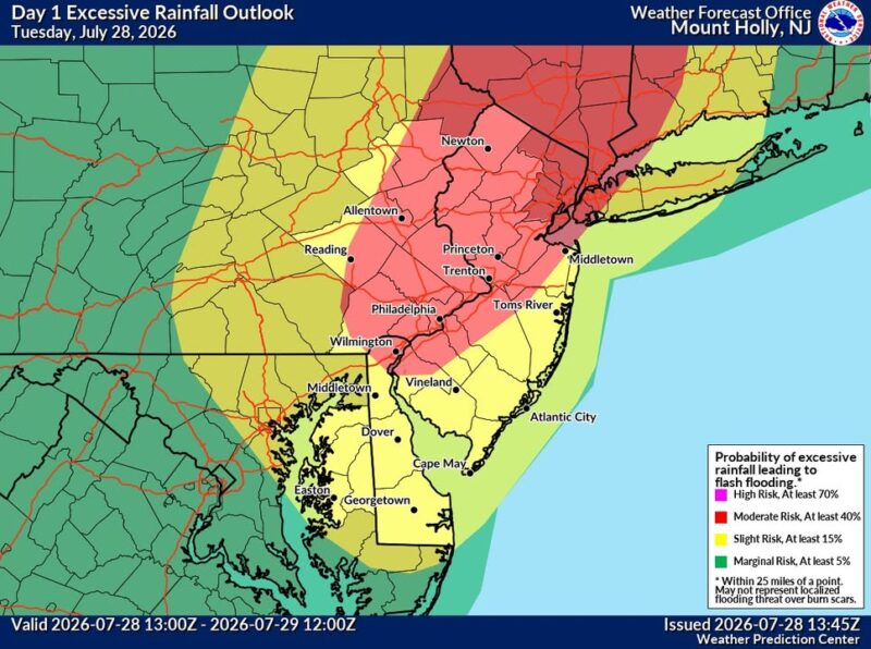
Heavy rain and severe storms expected
The Flood Watch remains in effect through Wednesday afternoon for portions of central and southern New Jersey, including Burlington, Camden, Gloucester, Mercer, Monmouth, Ocean, Salem, and surrounding counties. The watch also includes parts of Delaware and southeastern Pennsylvania.
According to the National Weather Service in Mount Holly, rainfall totals of 1 to 3 inches are expected, with locally higher amounts possible where thunderstorms repeatedly move over the same locations.
“Flash flooding caused by excessive rainfall continues to be possible,” the weather service said. “Excessive runoff may result in flooding of rivers, creeks, streams, and other low-lying and flood-prone locations.”
Severe Thunderstorm Watch covers most of the state
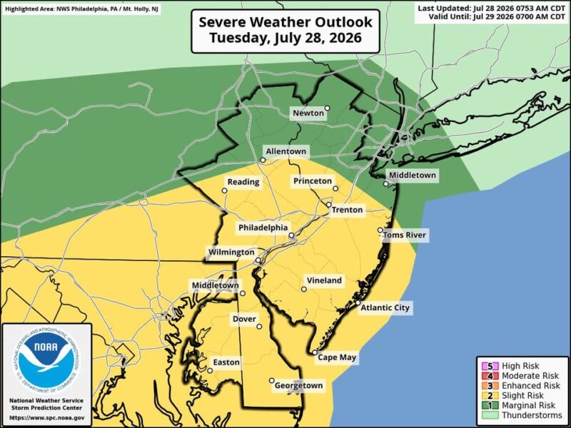
The Storm Prediction Center has also placed much of New Jersey under Severe Thunderstorm Watch 525 until 8 p.m. Tuesday.
The watch includes Atlantic, Bergen, Burlington, Camden, Cumberland, Essex, Gloucester, Hudson, Hunterdon, Mercer, Middlesex, Monmouth, Morris, Ocean, Passaic, Salem, Somerset, Sussex, Union, and Warren counties.
Damaging wind gusts are the primary severe weather threat, although frequent lightning, torrential rainfall, and isolated hail are also possible with the strongest storms.
What happens next
Thunderstorms are expected to continue into Tuesday night before gradually diminishing after midnight. Additional scattered showers and thunderstorms remain possible Wednesday afternoon and again Wednesday night, with more unsettled weather forecast into Thursday.
Residents are urged to monitor forecasts throughout the day and be prepared to move to higher ground if Flash Flood Warnings are issued. Drivers should never attempt to cross flooded roadways, as water depths can be difficult to judge and conditions may change rapidly.
Why it matters
Heavy summer thunderstorms can produce life-threatening flash flooding with little warning, especially in densely populated areas and along small waterways. The combination of saturated ground, intense rainfall rates, and strong winds could create hazardous travel conditions during the evening commute and overnight across much of New Jersey.